Das Geothermische Informationssystem (GeotIS) liefert Informationen und Datensammlungen über tiefe Aquifere in Deutschland, die für die geothermische Nutzung relevant sind.
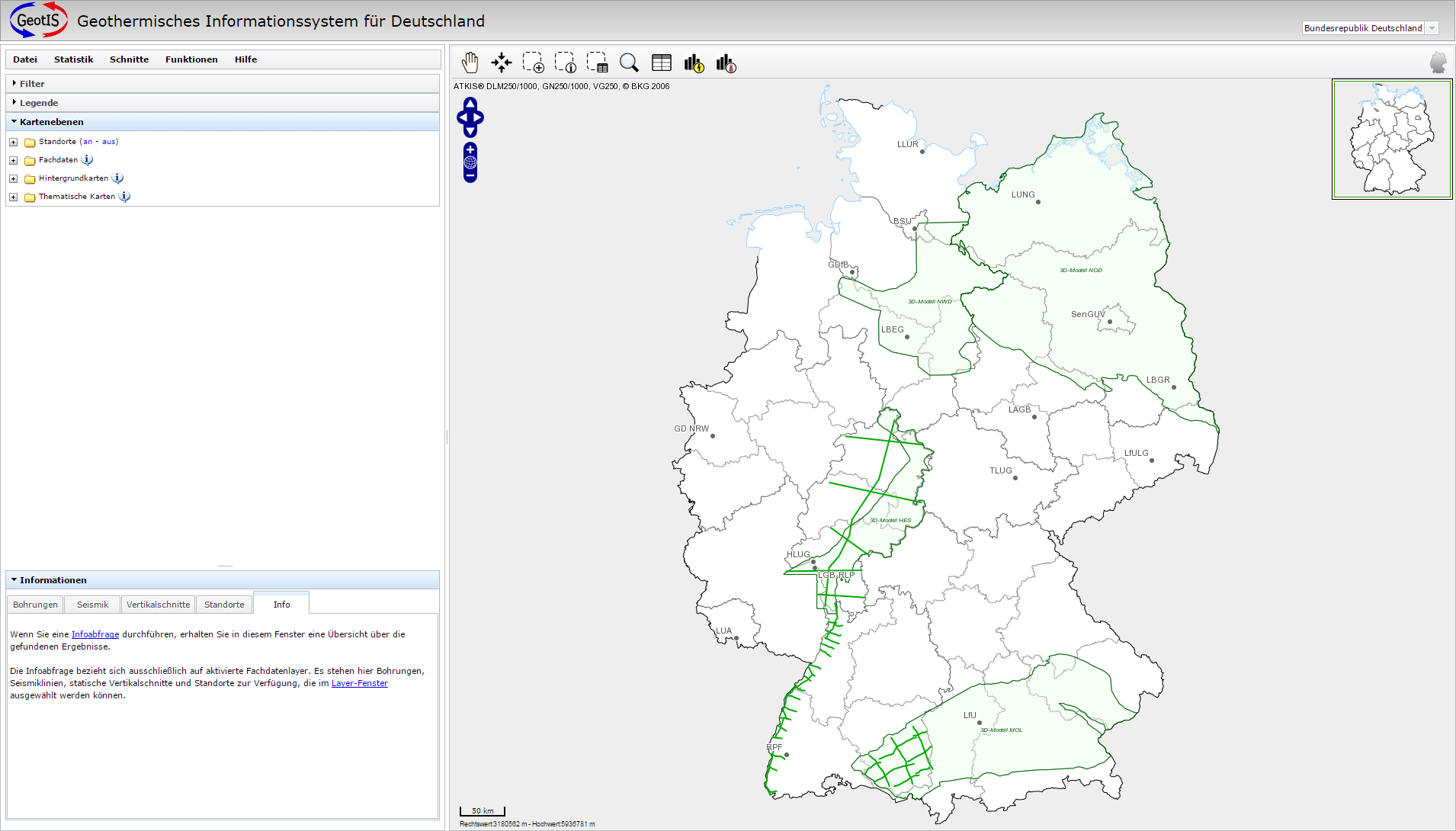
Der Zugriff auf die Daten erfolgt über die unten dargestellte Arbeitsoberfläche des Moduls "Geothermisches Informationssystem für Deutschland", deren Möglichkeiten im Folgenden kurz vorgestellt werden.
Kartenfenster:
Die Navigation in der Karte im Kartenfenster erfolgt mit Hilfe der Kommandos der Buttonleiste. Die Buttonleiste befindet sich über dem Kartenfenster. Diese Kommandos sind auch in der Menüleiste links vom Kartenfenster zu finden.
Informationsabfrage auf Bundeslandebene
In der Grundeinstellung werden alle Bundesländer im Kartenfenster gezeigt. Es ist aber auch möglich nur ein Bundesland aus der Auswahlbox zu wählen, sich die entsprechenden Daten anzeigen zu lassen und abzufragen.
Funktionen:
Die Menüleiste enthält unter anderem Funktionen, die aus den GeotIS-Datenmodellen Horizontal- und Vertikalschnitte erzeugen.

Im Layer-Fenster kann man die Standorte, Fachdaten, Hintergrundkarten und thematische Karten aktivieren, die in der Karte angezeigt werden sollen.
Filter-Fenster:
Im Filter-Fenster können Filter eingestellt werden, die auf die angezeigten Daten wirken und nur Daten im Kartenfenster anzeigen, die die Bedingungen der Filter erfüllen. Die Filtermöglichkeiten verändern sich entsprechend der angezeigten Daten.
Informationsfenster:
Im Informationsfenster können Filter auf Standorte, Bohrungen, Einwohnerdichte und Energieverbrauch angewandt werden. Die Elemente, die nicht den Filterbedingungen entsprechen, werden ausgeblendet.
Legenden- und Koordinatenfenster:
Entsprechend der aktivierten Kartenelemente stellt das Legenden-Fenster die Kartenlegende dar. Die rechts oben liegende interaktive Referenzkarte zeigt mit Hilfe eines Rechteckes die Position des Kartenausschnittes in Deutschland an. Der Maßstab des Kartenausschnittes und die aktuellen Koordinaten des Mauszeigers sind in der Karte zu sehen.

